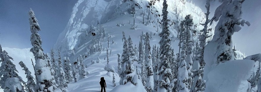

Our Alpine Club section has an agreement to maintain the west side of the Athabasca Pass trail with BC Recreation Sites & Trails from March, 2021 to March, 2026. The east side of the trail is within Jasper National Park, and info on that section can be found on their website including a PDF with info about campsites on the east side. Making a full traverse is difficult because of the Simon Creek crossing on the eastern side (not mention the logistics of the shuttle). (Photo by Marie Bellefeuille)
Maps and route info:
Basic hiking route is on Gaia GPS app – “Satellite Topo (Meters)” layer. Backroads Mapbooks (available in the paid/Pro layer in the app) has more detailed maps of the forest service roads to access the boat launch and trailhead.
Trail Condition:
The western section of the Athabasca Pass trail was maintained in the fall of 2022 – yellow trail markers and clearing the first 12 km or so. A bridge across Jeffrey Creek was washed out as of August 2026 (see this facebook post for details) The trail receives very little traffic and its ongoing condition is more like a 16km advised bushwack.
Trailhead Access
From Revelstoke, drive north on Route 23 past Mica Dam. Then, the road turns to dirt. Follow logging roads to this point/launch site:
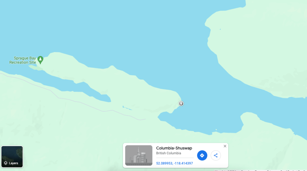
There is a good campsite with a bear hang directly across the lake, with good access to the road. Access to the trailhead is difficult because it requires crossing the Kinbasket Lake (a reservoir of the Columbia River known for changing water levels, cold water temps, and high winds) and travelling an additional 30km of logging roads and/or landing a boat near the Wood River bridge. The shortest crossing is gated and not accessible, as a timber ferry leaves from that point. There is a slightly longer crossing which is indicated on the map above. As of summer 2023, the roads are in great condition and can be ridden on gravel bikes for the most part, with some bushiness for the final 3km or so.
If you are able and willing, it could also be possible to land a boat near the Wood River Bridge.
Fall 2025 Trip Report East to West
Charlene Deck provided via Facebook – follow link for more great photos!
“Athabasca Pass – Moab Lake Road, Jasper to Wood Arm, Kinbasket Lake, BC
September 25-27, 2025
Moab Lake Road to Tie Camp – 18 km
We added 6.8 km to our day by parking at the start of the Moab Lake Road since we wouldn’t be back before the seasonal road closure.
The trail was straightforward and in good shape, and we benefited from the maintenance by JNP ecological monitoring crew on horseback.
Tie Camp to Athabasca Pass – 37.3 km
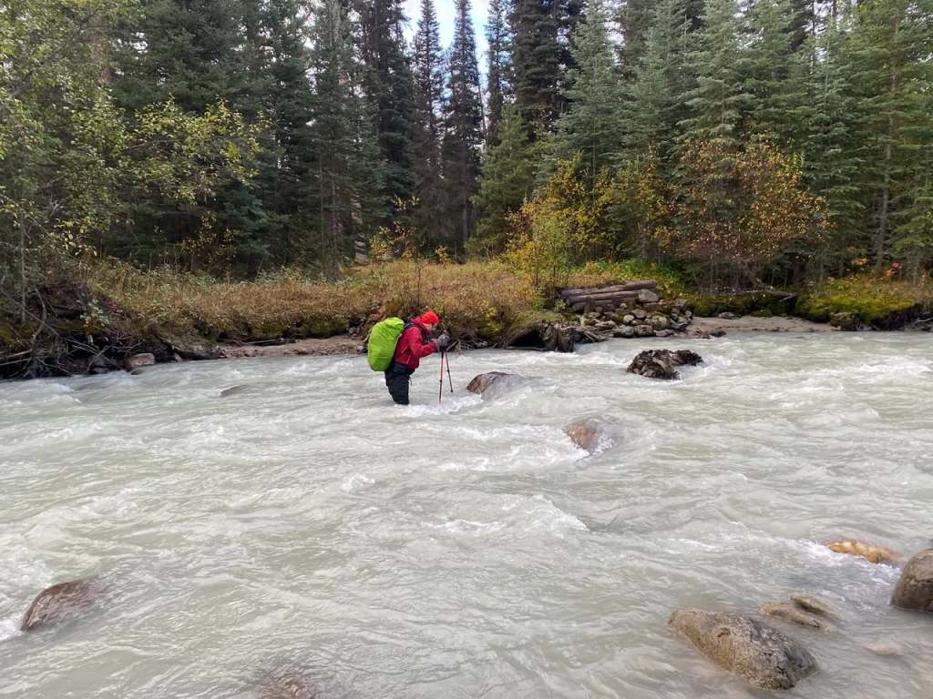
We got up in the dark to reach Simon Creek before the day warmed up. We scouted downstream, but a line near the old bridge looked safest to us, and we liked that our first steps would be in shallow water. My partner forded back and forth to test it out, then I tucked in behind him. The crux was the fast-moving water between the boulder he’s behind in the photo and the one to its right. The deepest was upper thigh on me (5’6”).
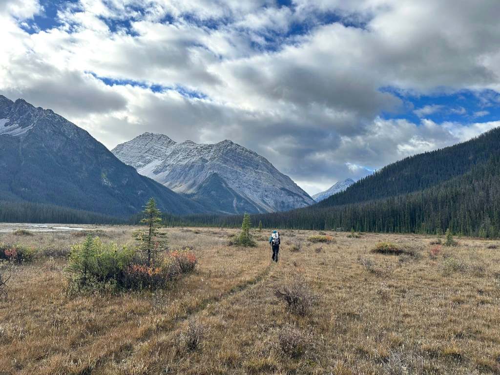
Overall, we found the trail well defined and easy to follow, with regular yellow markers in the trees. Sometimes it was a bit overgrown with willows that got us wet from overnight rain, but they weren’t thick or difficult to pass through. Where the trail went onto the floodplains, we just made our own way, sometimes picking up the trail but not worrying about it until we needed to catch it going back into the forest. After Scott Camp we got ahead of the horses so had to deal with some deadfall, the worst shortly before Kane Meadows. We lost the trail once but were near the meadows so just bashed our way there.
The trail up to the pass was lined with berries and we saw lots of bear scat. Approaching the pass, the trail was quite wet and less visible and we missed the turnoff to the campground. We popped out at a lake that wasn’t on our map and wondered if we had inadvertently arrived at the Committee’s Punch Bowl (we hadn’t).
Athabasca Pass to Wood Arm, BC – 28.5 km
At the pass we were surprised to see no one had signed the log book since 2023.*
The BC side starts out with a wade across the lake outlet. The trail was extremely well marked with frequent yellow markers, which we really appreciated since it rained all day and we could keep our hands in our gloves. The first part is more of a route since the spongey ground doesn’t hold the infrequent footsteps it receives, but the next marker was always visible. We pulled out the phone to navigate only once when we missed a marker. We could see all of the trail work that had been done and were very grateful for it, and any remaining deadfall was not too problematic.
The Herculean effort by ACC really became apparent on the steeper descent, where they managed to carve a route through huge deadfall. Where the trees weren’t cut, flags marked a reroute. We were so appreciative and impressed with the efforts to make this difficult terrain passable.
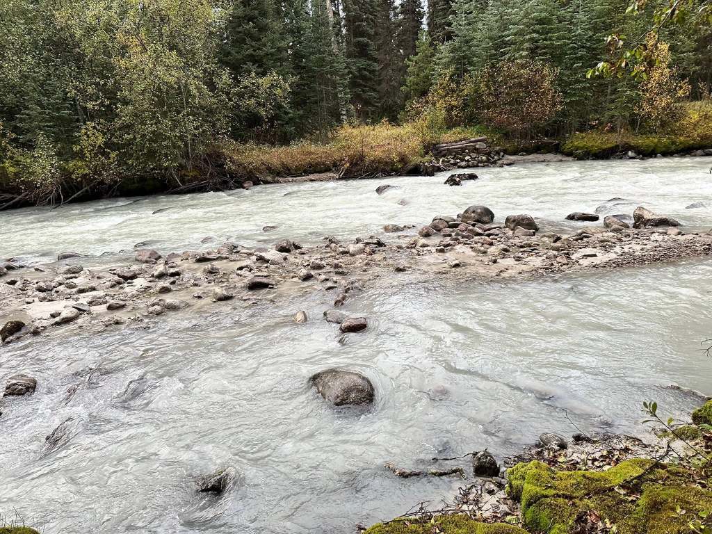
The valley floor showed signs of flooding as we made our way towards Jeffrey Creek. We crossed a few channels before reaching the damaged bridge, where we easily forded again downstream. We then picked up the trail in the forest along the Wood River floodplain before it leaves the river towards the trailhead.
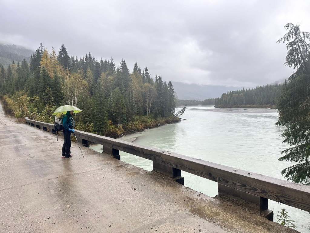
The first 3 km past the trailhead is an old road, making for fast walking, then another 5 km on FSR to the Wood River bridge. After crossing the bridge we continued for ~4 km and camped at a trapline cabin (52.19006, -118.16381), where we had dinner on the porch, finally out of the rain.
Our instructions were to meet our boat pick-up where the river meets the lake, which was a little less specific than I’d have liked since we’d never been in the area before. Luckily, right across the FSR from the cabin was a road down to the lake and an area known locally as “Camp Creek” (52.18873, -118.16503), which would be our pick-up spot (and also a good place to camp, had we known).
I enthusiastically recommend Captain Chris at Black Pearl Fishing Adventures. He’s a Revelstoke local and fishing guide who knows this ever-changing lake well. He and Lyle pointed out the sites along the lake until we arrived at Mica Dam where the truck was parked.”
https://www.facebook.com/groups/alpineclubcolumbiamtns/posts/3157780491089442
Summer 2026 Partial Trail Report:
Trevor Wilson from Facebook:
“LOGISTICS OF GETTING TO WEST END OF THE ATHABASCA PASS TRAIL: Contact Captain Chris Swanson of Black Pearl Fishing Adventures. He is very professional, experienced and has an ocean worthy boat very capable of dealing with the big waves that can occur in the middle of Kinbasket Lake. He took us to “Cabin Creek” (GPS 52.188627, -118.165008). If you look carefully on Google Maps, you will see a trapper’s cabin in the trees on the other side of the Wood River FSR. From there, it is 2.5 km walk on the Wood River FSR to Wood River Bridge (GPS 52.218428, -118.182286), then 8 km further to the Athabasca Pass Trailhead at (GPS 52.2786, -118.1579) From the trailhead, it is 2 km to Jeffrey Creek.The bridge that was built in Sept, 2022 over Jeffrey Creek has been smashed by the creek. Logs and debris collected on the upstream side and broke the big log that formed the bridge. Now the creek flows around the bridge.
Water is 1.5 ft deep in foreground, up to the little trees on the left. Beyond that, the creek is deep and fast. No go. I forded Jeffrey Creek, 30 inches deep, on July 4, 2026, about 100 m upstream of the confluence with the Wood River. My friends chose not to. It is better to ford this creek, at this location, Aug 15 to Sept 30 when the water level is lower.
Trail Conditions West trailhead to Jeffrey Creek: the trail is generally well marked with yellow diamonds and flagging. Go slow and watch the tread. There is a “water trench” section about 1 ft deep, firm bottom, 50 m long that ends on the flood plain.
Jeffrey Creek up to Athabasca Pass: trail is well marked with yellow diamonds. About 20 deadfall across the trail. Athabasca Pass to Simon Creek: this trail is cleared every year by the wardens of Jasper National Park on horses. They clear the trail to allow their horses through. Trip purpose is to download data from remote wildlife cameras.
Simon Creek: still no permission to build this bridge, despite much effort. See the last refusal letter attached.
Simon Creek to Moab Lake trailhead: some deadfall but route is clear.”

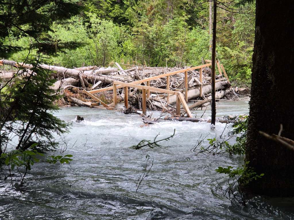
Jeffrey Creek washed out bridge. July 2026
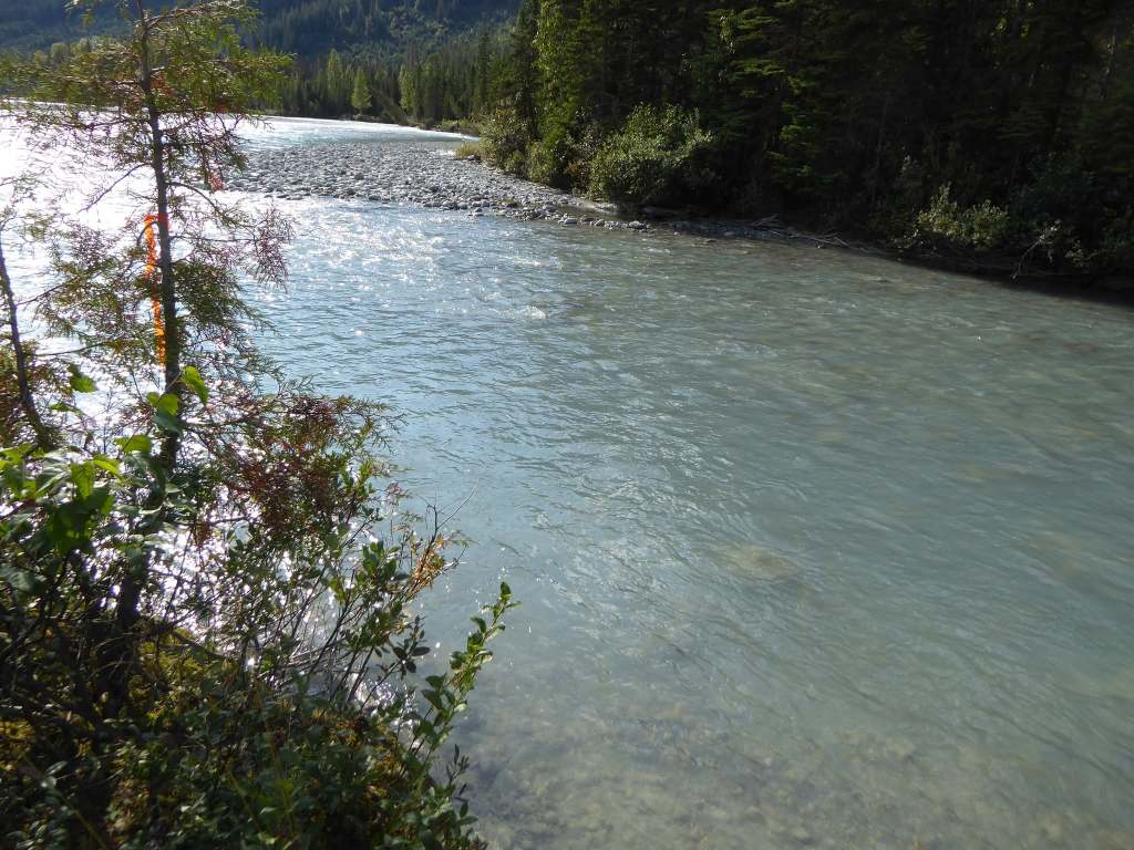
Jeffrey Creek fordable section during dry season (not July) 100m upstream from confluence with Wood River. Photo from Sep. 2022
Dan Albert: Facebook Trip Report – July 2026 (too much rain in Jeffrey Creek, traverse not completed)
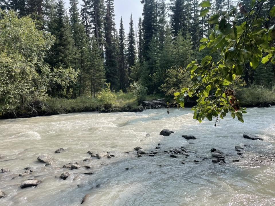
Kevin Kohl photo of Simon Creek (east side of pass) crossing in September of 2022 from comment of this Facebook post
Assorted Trail Inspiration:
Article in Revelstoke Review on the maintenance trip in 2022 by Donna Naprstek
Background article by CBC about why Simon Creek Bridge isn’t being replaced (2023)
Instagram recap of out-and-back canoe, bike, and run (2023)
Sprague Bay (BC Rec Sites): http://www.sitesandtrailsbc.ca/search/search-result.aspx?site=REC6062&type=Site
Boat Encampment National Historic site info https://www.pc.gc.ca/apps/dfhd/page_nhs_eng.aspx?id=110
Athabasca Pass Trail East info from Parks: https://www.pc.gc.ca/en/pn-np/ab/jasper/activ/passez-stay/arrierepays-backcountry/sugg-sentiers_trip-ideas#seven
Updated East Trail Conditions: https://www.pc.gc.ca/en/pn-np/ab/jasper/activ/activ-experience/sentiers-trails/etat-sentiers-trail-conditions
Athabasca Pass Trail Info:
https://hiiker.app/trails/alberta/alberta/athabasca-pass-trail/map
https://trailpeak.com/trails/athabasca-pass-near-jasper-ab-1833